Press "Enter" to skip to content

Gloucester plans … from 1974

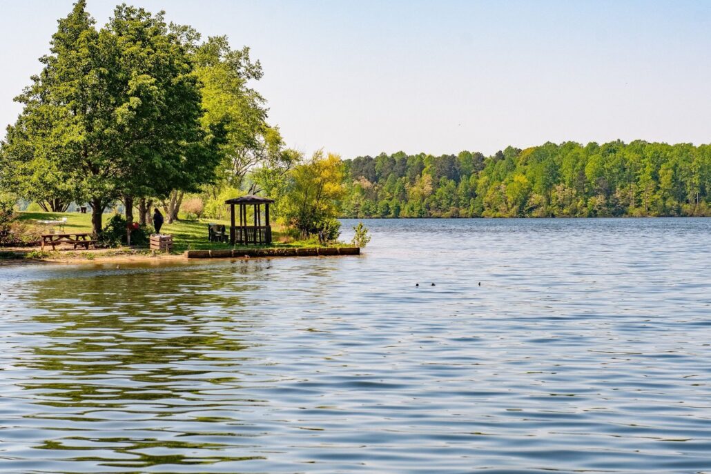
A parallel road between White Marsh and Gloucester Court House, east of Route 17. Didn’t happen.

Construction of eight new schools. Didn’t happen.

Containing growth to Gloucester Court House and Gloucester Point. Didn’t happen.

A park at Beaverdam. That definitely did happen.

A Gazette-Journal article from 50 years ago contained an outlook for Gloucester County in 2020; half a century after the analysis, that future is now. In this article we look at some of the forecasts, accompanied by modern-day commentary from Anne Ducey-Ortiz, director of Gloucester planning, zoning, and environmental programs.

According to Ducey-Ortiz, Gloucester County adopted its first comprehensive plan in 1974, and she said she believes the forecast, prepared for the county by Victor Gruen Associates, was part of this plan.

The first plan concentrated on future land use, traffic circulation, and community facilities, Ducey-Ortiz said. Updates and complete revisions of 1980, 1991, 1995, 2001, 2011 and 2013 have adapted to changing times.

The county’s first comp plan predates Gloucester’s adoption of a zoning ordinance in 1984 by a decade; it came nine years after the first subdivision ordinance of 1965. Both of these land use ordinances have also had periodic updates.

Then and now

The vision: the 1974 plan, as reported in the Gazette-Journal on Jan. 24, 1974, called for development to be concentrated at Gloucester Court House, White Marsh and Gloucester Point. The reality: “While the White Marsh Shopping Center is an active shopping center, this area hasn’t really developed with a concentration of residential and commercial activity like the other two areas,” Ducey-Ortiz said.

The 1974 plan called for low-density residential development at the Court House and medium density at the Point.

The reality: Ducey-Ortiz said “both areas have developed at what we consider high density residential” of three to four units per acre, “mainly because of the availability of water and sewer and the single-family zoning that allows 10,000 square foot lots on public water and sewer,” she said.
During the half century between 1970 and 2020, Gloucester County’s population exploded from 14,059 to 39,161, and for a period in the 1980s, Gloucester County was among the state’s fastest-growing localities. Population estimates in 1983 showed a growth rate of 14.5 percent, exceeded only by Stafford and Fredericksburg.

The vision: The 1974 plan called for multifamily housing “adjacent to the new Grant’s shopping center (now Main Street Center).” The reality: “While there is some multifamily off Lewis Avenue, most of the area has been developed as single family,” said Ducey-Ortiz.

The vision: In a time when the commercial seafood industry was probably stronger than it is today, the plan “supports the continued operation of all seafood processing plants.” The reality: “the county did provide sewer expansion to some of them … but the seafood industry has changed and we don’t have as many processing plants in the county,” said Ducey-Ortiz. She pointed out that Gloucester supports working waterfront of all kinds, desires to protect it in the current comprehensive plan, and has recently upgraded the wharf at Aberdeen Creek.

The vision: To promote easy traffic, the 1974 plan proposed “that Routes 610, 614, 616, 216, 198 and 602 be designated ‘major collector’ roads” and suggested relocating Route 614 at White Marsh to carry continuously across Route 17.” A parallel road east of Route 17 should be developed, the plan said, “connecting Gloucester and White Marsh.”

In reality: none of this happened. Ducey-Ortiz noted that part of Route 614 across Haynes Mill Pond was rerouted, but no parallel roads or other relocations took place. “Transportation continues to be an issue … the county relies on VDOT and state and federal funding for transportation improvements which are very costly and time consuming,” she said.

A side note: the 1974 plan was written a decade before a street naming project got underway countywide in 1985; and more than 15 years before E-911 emergency response was approved in Gloucester.

The vision: Planners in 1974 said, “To accommodate a population up to 40,000 in 2020, eight new schools would be required” to include new elementary schools in Gloucester Banks, Hayes, White Marsh, Deacon’s Neck and west of Gloucester, with an addition to Abingdon Elementary. One new intermediate school and one new high school were also envisioned.

The reality: Gloucester today has one high school, two middle schools, and Abingdon, Achilles, Bethel, Botetourt and Petsworth elementary schools. An additional elementary school, T.C. Walker, was discontinued in 2012 and now houses the division’s administrative offices.

The vision: The plan proposed that Gloucester Court House business district remain the county’s commercial center.

The reality: “This obviously has not been the case, but in general many of the larger businesses and fast-food restaurants are located in the Court House area; but commercial development is in many other areas … from the bridge to north of the Court House … James Store is the one location noted in the article that does not have any current commercial activity,” said Ducey-Ortiz.

The vision: Gloucester County would soon outgrow its office space in Botetourt Building, now the Gloucester Museum of History. Today’s reality: the county is served by a network of public offices, mostly around the historic court green. The courthouse has relocated twice since 1974.

The vision: “Expansion of firefighting facilities and utilization of a public hydrant system is suggested.” The reality, said Ducey-Ortiz: “Expansion of firefighting facilities and the use of a public hydrant system has occurred, but areas outside the development district are still on wells and dependent on dry hydrants and pumper trucks for firefighting purposes.”

The vision: Public recreational facilities could include playgrounds at all the elementary schools, plus improvement of public landings, development of parks including “one at the proposed park at Beaverdam Reservoir,”—then still years from being constructed—and preservation of historic sites and conservation areas. “Community parks are proposed at Beaverdam Reservoir, Haynes Pond, Powhatan’s Chimney at Rosewell Ruins. The park at Beaverdam would include hiking and bicycle trails and a community recreation center,” said that 50-year-old plan.

According to Ducey-Ortiz, “the vision for the park at Beaverdam … has been implemented with the exception of a community center located there. The plan called for improvement of existing public landings which hasn’t occurred at most, but recent improvements have been made to Deep Point Landing and John’s Point Landing. The special park proposed for Dragon Run to provide a shallow boat landing, picnic grounds and parking has not occurred, but the Dragon Run is given special consideration in the current comprehensive plan based on regional efforts to protect this unique watershed.”

Zoning has been used to protect many special natural areas in Gloucester, said Ducey-Ortiz. “Low density, conservation, agricultural zoning and environmental factors provide protection for the Dragon Run watershed, the Guinea Marshes, Purtan Island and Piney Swamp.”

One large development, long in planning and originally called The Barrens, is now under construction as “The Reserve at Gloucester Village.” Ducey-Ortiz said the buildout plan for this development south of Gloucester Court House is “1,142 single-family and townhouse units surrounded by open space and parklands.”

Looking at parallels between the 1974 plan and today, Ducey-Ortiz said “in general, this plan, and subsequent planning efforts, have similar visions for the county’s future development. The expansion of public water and sewer impacted the type and location of development in the County, but overall kept it on and adjacent to Route 17. Housing types are primarily single-family residential with density decreasing the further you get away from Route 17 and north of the Court House,” she said.

Continuing, Ducey-Ortiz said, “we have very little multi-family development in the County; however, this has changed somewhat over the last decade. The amount and types of infrastructure envisioned for schools, parks, and transportation had not occurred and current planning efforts focus mostly on using existing facilities to meet future needs based on costs and capacity.”

She said “commercial and economic development in the county is more service-based than industrial, and … Riverside Walter Reed Hospital is … one of the larger employers in the county, along with retail and government.”

Ducey-Ortiz noted the important role of nonprofit groups to help preserve historic and conservation resources such as Rosewell, Dragon Run, and many others that have been identified since 1974.

Fifty years ago, a planning group peered through the looking glass at 2020. Now in 2024, we can speculate what 2074 will bring for Gloucester County. If anyone is working on this plan, we have not heard of it.

Gloucester County Administrator Carol Steele she was “fascinated and a little surprised by how specific these projections were” and that “This was at the time we were just starting our comprehensive planning process—taking a look at what we had and where we wanted to go. We really did not know what to expect.”

“From a population standpoint,” Steele continued, “they overestimated because the growth rate was so high at the time. It stalled for a while, but is back growing again. However, we don’t anticipate as much growth as we saw in the 1980s. While we see many of our neighboring localities losing people, we are growing.

“Transportation was an obvious issue at that time. There was a lot of discussion about putting in alternate roadways, and a lot of that work was never completed. If it had been done, we would be in a lot better shape than we are now.”

Looking ahead herself, Steele said, “County administration and planning staff are very concerned about traffic patterns and we are working on providing as much information as possible to the board of supervisors to help with future planning.”