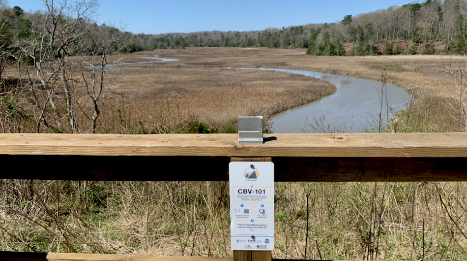
Have you ever gazed out across a Chesapeake Bay scene and wondered what it looked like in the past, or might look like in the future? Thanks to educators at the Virginia Institute of Marine Science, you can now do exactly that using a new photo monitoring tool at York River State Park between Williamsburg and Richmond. Sarah Nuss, education coordinator for the Chesapeake Bay National Estuarine Research Reserve in Virginia, led the effort to install a “Chronolog” at a popular vantage point within the 2,500-acre park. The physical Chronolog platform features a rigid bracket designed to hold cell phones so that sequential visitors to a particular locality can capture a consistent scene through their phone’s camera lens. Once shared with the chronolog.io website via email, software stitches the images into a time-lapse photo series that illustrates the changing environment—in this case, the changing landscape of Taskinas Creek and adjacent woodlands. The meandering, marsh-lined waterway, w...
To view the rest of this article, you must log in. If you do not have an account with us, please subscribe here.